Successfully selected as one of the top ten innovative application scenarios in Shandong province for 2025 real-life 3D, MapGIS supports the construction of Jinan rail transit
To implement the Digital Strong Province strategy and fully showcase the positive achievements of real-world 3D data elements in innovative applications, promote typical experiences and practices. At the end of March 2025, the Shandong Provincial Department of Natural Resources and Shandong Provincial Big Data Bureau initiated the solicitation and evaluation work for the Top 10 Innovative Application Scenarios of Real-World 3D Shandong in 2025. All cities and units attached great importance, widely mobilized, carefully organized, and actively participated, collecting a total of 158 application scenarios. After multiple rounds of expert evaluation and public announcement, 10 scenarios including "Real-World 3D Empowerment to Strengthen Urban 'Lifelines'" were determined as the Top 10 Innovative Application Scenarios of Real-World 3D Shandong in 2025. Among them, the Jinan rail transit construction supported by the MapGIS basic platform was successfully selected.

This image is output by MapGIS platform
Construction Background
Jinan, known as the "City of Springs" due to its numerous springs, faces increasingly prominent "traffic congestion" problems with urban development and population growth, making subway construction urgent. After 30 years of deliberation, how to coordinate the relationship between subway construction and spring protection has always been a difficult problem in Jinan's subway construction. Traditional information platforms have obvious shortcomings in supporting underground space development, dynamic geological environment assessment, and urban planning decision-making, and are difficult to provide accurate, comprehensive, and multi-scale geological data support.
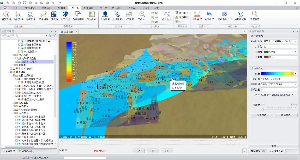
The four-dimensional geological environment information platform can achieve unified storage, management, and display of multi-source, massive, and heterogeneous geological data and related materials, realize seamless connection between geological structure and groundwater model, vividly display the relationship between subway construction and spring protection, and can be applied to the entire life cycle of subway planning, construction, and operation, providing new ideas for resolving the contradiction between subway construction and spring protection.
Construction Content
The platform construction is based on the MapGIS basic platform, with the four-dimensional geological environment database as the data foundation. Facing system administrators, professional technicians, management personnel, and the general public, it adopts a C/S and B/S combined architecture to build a geological data management and maintenance platform, a four-dimensional modeling and visualization platform, a four-dimensional geological environment decision-making service platform, and a four-dimensional geological environment public information platform. At the same time, based on the four-dimensional geological environment visualization information system platform, an underground 3D geological structure model is established to achieve integration of above-ground landscape (3ds), building models (3ds), underground 3D geological structure models, underground pipeline models, subway models (BIM), underground water flow models, and groundwater level models, realizing integrated display of above-ground and underground, providing decision support for all stages of urban rail transit network planning, design, construction, and operation maintenance.

This image is output by MapGIS platform
Application Results
The four-dimensional visualization technology achievements for above-ground and underground依托 on the first and second phase construction of Jinan rail transit have realized full life cycle application in rail transit construction, which is of great significance for Jinan spring protection, underground space development and utilization, and smart city construction.
First, in the planning stage, relying on the four-dimensional platform, automatic section cutting function can be achieved to grasp information such as stratum structure, lithology, geological structure, karst development characteristics, and hydrogeological conditions along the rail transit route, realize argumentation on the impact of structure and construction on springs and suitable burial depth, reduce subway exploration borehole quantity by 28%, improve geological risk identification completeness by 41%, and play an important guiding role in suitability analysis of rail transit routes.
Second, in the investigation and design stage, the distribution areas of adverse geological bodies such as highly permeable clay, karst caves, hard rock, and isolated boulders that may be encountered during construction are predicted, and these are avoided during the design stage, saving engineering costs of 12.15 million yuan per bid section and shortening the construction period by 19.3%.
Third, in the construction stage, based on the distribution range and occurrence of adverse geological bodies such as karst caves, hard rock, and isolated boulders along the route, shield machine types and key parameter configurations are intelligently matched, and the cutter head tool selection scheme is optimized, saving an average of 5.59 million yuan in equipment costs per project annually. Fourth, in the operation stage, the four-dimensional geological platform digitally and visually sets the designated protected area range, clearly identifies the location of engineering structures intruding into the protected area, evaluates the impact of construction projects on rail transit structures, and provides auxiliary decision-making.

Multi-dimensional and multi-perspective analysis of geological environment of subway planning routes
The results have been promoted to 7 domestic units including China Railway 18th Bureau Group Co., Ltd., China Railway Shanghai Engineering Group Co., Ltd., China Railway Fourth Survey and Design Institute Group Co., Ltd., and Beijing Urban Construction Survey and Design Research Institute Co., Ltd., achieving good application effects in 73 engineering projects including investigation, design, and construction, especially in the field of urban rail transit.


