


More Applications
Provide high-quality solutions and services for more industry users and partners
A new generation of communication network resource sharing service platform developed based on MapGIS platform, which efficiently combines GIS technology, database technology, computer network, and communication network management automation to achieve refined, visualized, intelligent, and full lifecycle management services for communication network resources.
I. Resource Management Solution
With its advanced functional repository, data warehouse, and workflow engine, as well as configurable, buildable, and plug-in development models, this system effectively supports rapid application system construction. Complete functional building blocks and service interfaces comprehensively meet the network resource system construction needs of the telecommunications industry. The innovative multi-level AM/FM/GIS network model seamlessly integrates new network technologies. The service-oriented open architecture helps telecommunications enterprises protect previous investments, achieve data sharing and functional integration, and enhance service capabilities.
The new generation of telecommunications network resource management systems will improve telecommunications enterprise management, operations, and service levels with more advanced network resource management, smoother functional integration, and broader business support, creating new enterprise value.

Telecom Network Resource Sharing Platform Features
Network Resource Layered Management Model: Network resources are managed in layers with weak correlation between data levels.
Equipment Types and Attributes Can Be Quickly Configured: Supports maintenance management of various hardware equipment and facilities, and can quickly configure and expand new equipment.
Support Front-end Business Processing and Back-end Installation & Maintenance: Provides equipment line capacity information for front-end business processing; provides optical path routing and port configuration information for back-end installation and maintenance.
Support Mobile Resource Management: Features mobile applications based on handheld devices to enable resource management anytime, anywhere.
Assist Network Overall Planning: Supports online project process management and resource data planning and design, achieving a closed loop between planning and resource data maintenance processes.
Support Rapid Integration of New Network Resources: Fully supports the development and application of core technologies such as NGN and IMS; supports new services like the广电 industry's two-way transformation hybrid network model.
Telecom Network Resource Sharing Platform Service Content
Map Access and Management Services
The platform supports display and management of electronic maps of various scales, high-precision aerial imagery maps, and remote sensing image maps. It supports OGC standards and mainstream online map data formats.
Network Resource Visual Entry and Management Services
The system provides visual entry and management services for telecommunications network resources, including resource entity attribute management and panel management for cable networks, optical cable networks, bearer networks, coaxial cable networks, and广电 bidirectional networks.
Resource Line Logical Relationship Management
The system supports equipment line association relationship management such as cable laying, splicing, termination, and jumper connections, and provides connection logic relationship checking and verification functions to proactively discover network resource data connection logic issues.
Comprehensive Data Query and Display Services
Provides users with various query modes such as map browsing query, map frame selection query, attribute condition query, and area query, intuitively and vividly displaying network resource data.
Network Resource Data Analysis and Report Services
The platform provides multi-condition, multi-dimensional query and statistical report functions, with statistics covering cable networks, optical cable networks, pipeline pole networks, data transmission networks, and business information. Quickly supports customers' customized personalized statistical report requirements.
Resource Reservation and Confirmation Services
Based on the address information provided by users, the system displays the business capabilities of resources associated with that address, assists sales staff in business demand judgment, and provides accurate resource confirmation services for business processing, significantly improving processing efficiency and first-time business activation rates.
Customer Online Self-Service Site Selection
With the development of the Internet and the acceleration of life pace, online business processing has become a new choice for people. Starting from actual needs and combining with Internet public service models, the system implements online site selection applications to support self-service business processing in online service halls and customer service phone processing.
Business Line Configuration and Management Services
The system supports both automatic and manual configuration modes for business lines. It provides functions for creating, deleting, and adjusting optical paths in traditional optical networks and EPON networks, and can display routing diagrams, logic diagrams, etc., providing support for front-end operations and back-end operations and maintenance.
Map Drawing Services
The platform can automatically generate various drawings and comes with drawing editing and embellishment functions. It supports saving drawings as local files, CAD, uploading to servers, and other storage methods. By accessing historical drawings on the server, it can view the migration history of resources, helping customers with design, construction, and network planning.
External Line Installation and Maintenance Support Services
To address the external line installation and maintenance issues of telecommunications enterprises, the system provides a new generation of mobile resource management systems, using the open cloud GIS mobile platform--MapGIS Mobile 10 platform, which allows users to directly use mobile devices such as phones to query, maintain, and manage resources without time and location restrictions, and provides installation and maintenance technology sharing forums and learning training material download services.
Planning, Construction and Project Management Services
The platform provides business process management services, conducting process management and monitoring of project process approval, project progress monitoring, project design, project material statistics, project cost estimation, and other functions, integrating and optimizing internal enterprise processes, improving work efficiency, reducing communication costs, and enhancing customer satisfaction.
II. Enterprise-level GIS Platform Applications (Series) Solutions
(I) Enterprise GIS Information Intensive Management Solution


Typical Cases
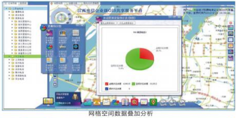
● China Telecom Group Jiangxi Provincial Company Enterprise GIS Sharing Platform
● China Telecom Group Hunan Provincial Company Enterprise GIS Sharing Platform
● Hunan Telecom Intelligent Space Address Library Management Platform
● Shaoxing Telecom Intelligent Place Name and Address Site Selection Platform
● Huzhou Telecom Intelligent Place Name and Address Site Selection Platform
● Beijing Post Office Civil Affairs Address Information Management Solution
(II) Enterprise Marketing Support Solution

Typical Cases
● Jiangxi Telecom Grid-based Marketing System
● Jiangxi Telecom Liangda Map Application
● Hunan Telecom Grid-based Marketing System
● Hunan Telecom Agent Settlement System
● Hunan Telecom Map Liangda Map Application
● Zhejiang Telecom Grid-based Marketing System
(III) Enterprise After-sales Customer Service Support Solution
Wireless Network Optimization Platform
The wireless network optimization platform mainly provides optimization for 2G, 3G, 4G, and WLAN of the three domestic telecom operators: China Mobile, China Unicom, and China Telecom. The optimization is divided into front-end and back-end. The front-end mainly addresses outdoor testing discovered RF issues, parameter adjustments, coverage beyond designated areas, unreasonable handovers, interference, and other problems; the back-end is mainly used to handle problems discovered through daily monitoring and KPI indicator monitoring and improvement. Front-end and back-end cooperate and adjust with each other to optimize the existing wireless network, ultimately enabling users to have a good network usage experience.

Optical Fiber Intelligent Monitoring Platform
Based on the enterprise-level GIS platform, connecting with major customer network management, equipment network management, integrated network management, and new equipment network management systems, a network fault intelligent monitoring platform can be quickly built.
Advanced COTDR (Coherent Optical Time Domain Reflectometer) technology. Compared to traditional OTDR, the impact of blind zones and crosstalk is smaller.
Low-power laser, uniquely encoded modulated continuous weak laser pulse signals, longer detection duration.
High accuracy in feeder segment positioning resolution, 100km long-distance positioning accuracy can reach 1m, accurately obtaining information such as link length, loss, joints, and fault locations.
Supports PON networks. COTDR detection signals are combined into optical fiber lines through a multiplexer, and through the reflector of the ONT terminal device, the system can directly detect faults that may occur in the feeder segment and after the optical splitter and accurately locate them.
Real-time online detection. Does not occupy backup fibers, does not affect in-use optical fiber services, avoiding resource waste.

Typical Cases:
● Zhejiang Telecom Wireless Network Optimization Assistant
● OFILIN Intelligent Service Optical Fiber O&M System
(IV) Enterprise Value-added Service Solutions
Enterprise Mobile GIS Monitoring Platform
To address issues faced by enterprises or institutions such as uncontrollable mobile monitoring field personnel, slow emergency response to monitoring discoveries, and untraceable monitoring trajectories, our company has launched an enterprise mobile GIS monitoring solution. The platform combines mobile handheld terminals and PC management terminals, real-time transmitting personnel trajectories and monitoring information, achieving precise management of field personnel positions, real-time transmission of monitoring information, real-time dispatching of sudden problems, and post-analysis of monitoring implementation, enhancing the overall management methods of enterprise mobile monitoring business.
The main functions of the enterprise mobile GIS monitoring platform are as follows:
Organizational Structure Maintenance: Including enterprise organizational structure management, mobile terminal management, personnel management, and vehicle management.
Task Customization and Distribution: Including mobile monitoring plan template management, monitoring plan formulation, and monitoring plan completion result display.
Route Navigation: The system provides real-time GPS positioning and route navigation functions.
Positioning Services: Including personnel positioning and vehicle positioning, can determine whether the current monitoring route deviates according to the monitoring plan trajectory, and provide deviation alarm prompts.
Field Monitoring Module: Contains multiple functional modules such as collection center, task center, data update, vehicle dynamics, personnel dynamics, and satellite information, supporting field monitoring personnel's monitoring task reception, monitoring trajectory transmission, monitoring point result transmission, and satellite information viewing operations.
Hotspot Query and Positioning: The system supports various query search methods and can display associated information of positioning points.
Personnel/Vehicle Monitoring: Displays all personnel and vehicles currently executing monitoring task plans on the BS system interface, and can further view monitoring plan execution details and transmitted information.
Trajectory Playback: Displays monitoring plan routes and actual inspection execution routes on the BS system interface, and can view images and text information transmitted in the monitoring trajectory.
Application Cases
● Baicheng Mobile Industrial and Commercial Law Enforcement Pass
● Wuhan Intelligent Parking Navigation Application
Related Software
Smart City
- Smart City Spatiotemporal Big Data Platform
- MapGIS Smart Thermal Solution
- Smart Emergency Command Platform
- MapGIS Field Work Order Solution
- Enterprise One Picture Solution
- Smart Security Combat Platform
- MapGIS Pipeline GIS Solution
- Smart Chemical Industrial Park Solution
- Smart Patrol and Prevention Platform
- MapGIS Integrated Management System Solution for Underground Municipal Facilitie
Natural Resources
- National Land Space Basic Information Platform: Smart Hub
- National Spatial Planning Implementation Monitoring Network (CSPON)
- Real estate convenience service system
- Realistic 3D Solution
- Natural Resource Asset Management Solution
- One code land management solution
- Ocean monitoring solutions
- Intelligent Disaster Management Solution
- Integrated solution for natural resources e-government
- Land survey solution
Smart Geology
- MapGIS Digital Twin Watershed Solution
- MapGIS Groundwater Informatization Solution
- MapGIS Iterative Geological Modeling Tool
- Geological Informationization Solution
- MapGIS Geological Data Management and Display System
- MapGIS Field Data Collection System
- MapGIS Smart Environmental Protection Solution
- Integrated solution for urban geology above ground and underground
- Geological big data cloud platform
- MapGIS Mining Management and Modeling System
More Applications
- Series solutions for the communication industry
- MapGIS CIM Underground Space Platform
- Smart wind power solution
- Solution for Radio and Television Resource Management
- Transportation Meteorological Support Service Solution
- High performance processing solution for remote sensing images
- Multi source remote sensing data management solution
- Solution for Multi source Meteorological Information Integration Application and Service Platform
- Solution for Visualization Platform of Meteorological 3D Storm Body Echo Data
- Solution for Weather Radar Construction Business Platform


