


NRSMA
Provide one-stop land survey data services, application services, and specialized product services to natural resources departments, government departments, and research institutions.
Provide one-stop land survey data services, application services, and thematic product services for natural resources departments, government departments, and research institutions.
County-level Third National Land Survey Database Management System
The land survey database management system is designed primarily to meet the management needs of county-level administrative units' land survey databases, including functions such as annual land batch changes, incremental results export, monitoring patch management, land use analysis, query statistics, and results output. It can assist operational units in quickly and efficiently completing annual land change survey work, meeting the daily office needs of grassroots natural resources authorities.

County-level Third National Land Survey Field System
The system integrates GPS positioning, data collection, base map loading, photo evidence collection, and other functions, enabling integrated collection of graphic and attribute information to achieve paperless operations. It supports on-site point and line parsing and various precise captures, achieving accurate collection of common boundaries and solving the problem of extracting common boundaries of adjacent patches. It can also connect to network reference stations for real-time differential, ensuring high-precision measurement data acquisition from multiple aspects, reducing secondary indoor sorting work. It quickly generates national standard format evidence result packages, achieving an integrated operation model of internal-external integration and verification evidence integration.

Provincial and Municipal Land Survey Database ManagementSystem
Manages various spatial and non-spatial data including remote sensing image data, second survey data, third survey data, monitoring patches, evidence results, statistical reports, thematic maps, and metadata. Combines traditional GIS database engines with distributed databases, providing efficient data management, system maintenance, and data processing tools.

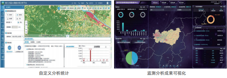
Provincial and Municipal Land Survey Decision Analysis Subsystem
With land survey results application scenarios as the core, it provides basic application services such as big data visualization, flow analysis, query analysis, special analysis, intelligent summarization, and map output, providing service support for natural resources authorities and related government departments in conducting land survey-related approvals, supervision, and decision-making.
Land Survey Shared Service Subsystem
With establishing a sharing mechanism as the core and resource integration as the main line, it efficiently integrates data services, natural resources application services, and thematic product services, uniformly summarizing natural resources information related to the third land survey and special surveys to form an authoritative and standardized shared service portal. This allows different departments to achieve multi-source information exchange, sharing, integration, and application under unified standard interfaces in heterogeneous platform environments, breaking information barriers between different platforms and industries, and providing one-stop natural resources geographic information services for governments, enterprises, and the public at all levels.

Application Cases:
Hebei Province Third Land Survey County-level Land Survey Database and Management System Software Project
Shandong Province Land Survey Planning Institute Third National Land Survey Database System Project
Sichuan Province County-level Third Land Survey Database Management System Project
Guizhou Province County-level Third Land Survey Database Management System Project
Shanxi Province County-level Third Land Survey Database Management System Project
Guangdong Province Third National Land Survey County-level Control Area Calculation Software Development Project
Related Software
NRSMA
NRSDMS
- Natural Resource Asset Management Solution
- Intelligent Disaster Management Solution
- Solution for Urban Physical Examination Evaluation Information
- Implementation Supervision Information Solution for the "One Map" of National Spatial Planning
- Solution for Land Space Use Control and Supervision
- Green Mining Intelligent Solution


