


Successfully shortlisted! Zhongdi Digital has been included in the semi-finals o
Zhongdi Digital started with CAD mapping software and leveraged its decades of experience in the geographic information system (GIS) industry to make precise efforts in the field of low altitude economy. The low altitude airspace digital mapping system constructed by Zhongdi Digital has industry adv

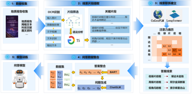
GIS Intelligent Engine Products: Technological Evolution Empowered by AI Computing Power for Geological Exploration
Since MapCAD revolutionized the history of geological mapping with digital strokes, China's geological exploration industry has been pursuing deeper technological breakthroughs. With the wave of AI technology sweeping across the entire industry, Zhongdi Digital has launched the GIS Intelligent Engine · AI Geological Exploration Supercomputing Station, comprehensively improving the technical level of AI application in the geological exploration industry under strong inference models, and promoting the leap of China's geological exploration work from "manual experience exploration" to "AI computing exploration". GIS Intelligent Engine · AI Geological Exploration Supercomputing Station is a DeepSeek training/pushing hyper fusion machine based on Huawei hardware platform, deeply adapted to DeepSeek V3&R1

Leaders from the Natural Resources Comprehensive Survey Command Center of the China Geological Survey visited Zhongdi Digital for research
On March 27th, Li Jian, member of the Party Committee and Deputy Director of the Natural Resources Comprehensive Survey Command Center of the China Geological Survey, led a team to Zhongdi Digital for research and exchange. The company's Chairman Liu Yong, Vice Chairman Wu Liang, President Zhang Liang and other senior executives participated in the reception. Both sides exchanged ideas on geological information technology innovation, localization substitution and migration, and future cooperation directions, working together to promote the deep integration of geological scientific research and industrial applications
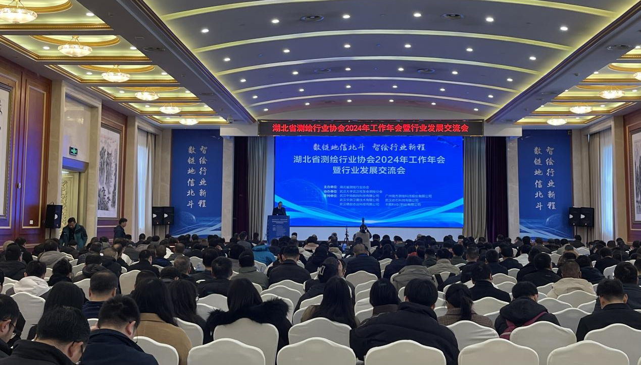
Zhongdi Digital showcases its full stack Xinchuang GIS achievements at the annual meeting of Hubei Surveying and Mapping Industry Association
On March 6, the 2024 Annual Work Conference and Industry Development Exchange Conference of the Hubei Provincial Surveying and Mapping Industry Association was grandly held in Wuhan. The conference, themed "Digital Chain for Geospatial Information and BeiDou, Intelligent Mapping for a New Journey in the Industry," focused on cutting-edge technologies such as h...
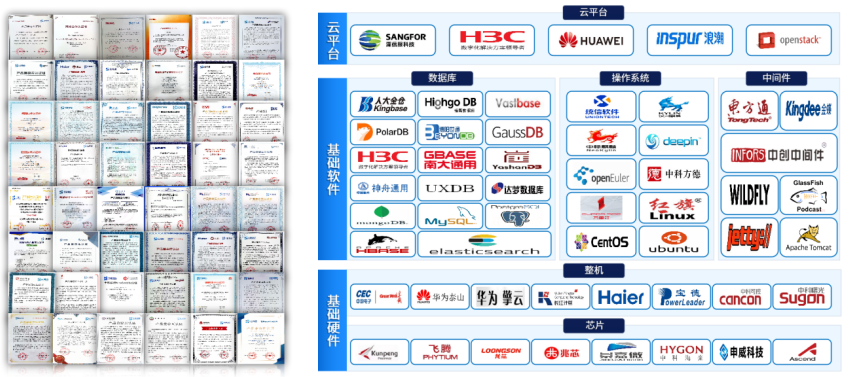
Breaking through the bottleneck technique! MapGIS creates a new benchmark for national industrial GIS platform
In the context of the complex and ever-changing international situation, independent and controllable technology has become a key defense line for national strategic security. As a core technology in the field of geographic information, GIS's localization process plays a crucial role in ensuring national geographic information security and promoting the development of the digital economy. So, as the process of information and innovation substitution enters the core technology breakthrough period, the geographic information industry is facing a critical decision: how to achieve secure and accurate substitution from chips, operating systems to GIS platforms while ensuring business continuity? Zhongdi Digital launches MapGIS national production replacement solution, accumulating over 30 years of independent innovation ..


